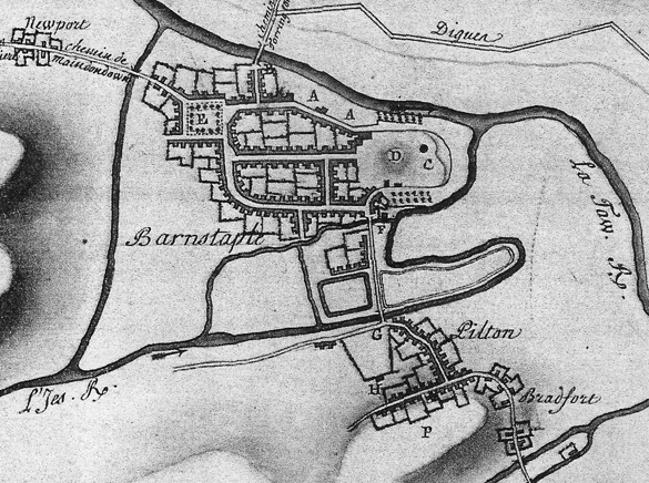
In 1768 the French produced a map of the Taw and Torridge Estuaries and hinterland showing the main habitation and geographic features. It was one of a set detailing all the ports and inlets on the southern coast of England and the Bristol Channel, drawn by a French spy on a mission to discover likely invasion points.
As well as Barnstaple, Instow and Appledore, the map shows the locations of Pilton, Bradiford, Heanton Punchardon, Newport, Upcott House and it also mentions Pilton House (the home of Robert Incledon completed in 1746). This illustration below is an extract from the larger map. For the full map with the key to the features, click on the illustration to open The Pilton Story archive.
The first French Army of England gathered on the English Channel coast in 1798, but an invasion of England was sidelined by Napoleon’s concentration on campaigns elsewhere and then shelved in 1802. However, his planned invasion of the United Kingdom at the start of the War of the Third Coalition (1803-06), although never carried out, was a major influence on British naval strategy and the fortification of the coast of south-east England. Fourteen hundred French did invade at Carreg Gwastad, near Fishguard, Pembrokeshire in 1797 but were captured.

